-
Europe’s first test area for UAV-based traffic management opens at Twente Airport in the Netherlands
-
Nokia signs collaboration agreement to support development and testing of its drone traffic management platform at Twente Airport
-
Initiative lays foundation for future global standards for automated traffic management to ensure safe drone use in the vicinity of manned flight operations
26 September, 2016
Twente, the Netherlands – Nokia is to support Europe’s first dedicated testing facility for the use of unmanned aerial vehicles (UAV) for traffic management. The facility, at Twente Airport, near Enschede in the Netherlands, will enable Nokia to develop and trial its UAV Traffic Management (UTM) system for the use of drones in proximity of urban areas, people, manned aircraft, other drones and hundreds of other objects.
Under a Memorandum of Understanding signed with the Municipality of Enschede, the Province of Overijssel, Unmanned Systems Center B.V. and Area Development Twente, Nokia will design and deliver the infrastructure to test and develop the Nokia UTM system at Twente Airport through real-life simulations and commercial demonstrations.
The Nokia UTM solution will provide the flight automation, no-fly zone control and beyond-visual-line-of-sight (BVLOS) capability that will be vital for the safe operation of UAVs in densely populated cities, as well as remote rural areas. UAVs must be able to operate without endangering manned aircraft operations, requiring the development of highly dynamic no-fly zones together with enforcement of civil aviation regulations.
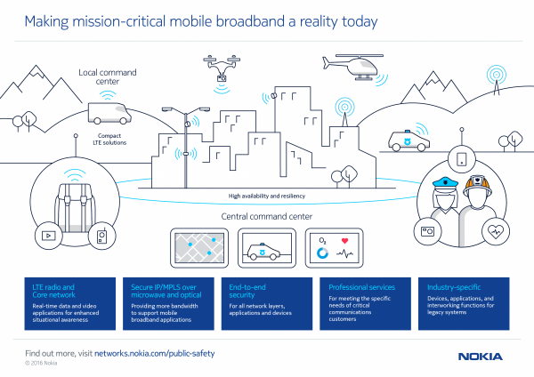
The Nokia technology is underpinned by a combination of expertise in LTE and 5G development, a well as Mobile Edge Computing, to ensure the extreme low-latency and ultra reliability required for UAV traffic management. Drones equipped with Nokia’s UTM modem (comprising an LTE modem, GPS transceiver and other telemetry modules), combined with the computing and processing power of the Nokia AirFrame platform, monitor airspace and, flight paths. They can also handle the exchange of telemetry data as well as extablishing dynamic no-flight zones, ensuring safe operation around other civil airspace users. A Nokia UTM smartphone app, working with the UAV Traffic Management interface, provides drone operators with real-time flight permissions, real-time no-fly zone information as well as information about local regulatory rules, giving an extra degree flexibility and awareness.
The Nokia UTM platform can also be adapted to the individual regulatory requirements of different countries, potentially providing the basis for global standardization of such systems.
During an opening day event of Space 53, the test area at Twente Airport, visitors will be able to see a wide range of demonstrations of UAV uses in agriculture, search and rescue, public safety and airport anti-bird protection.
Thorsten Robrecht, head of Advanced Mobile Networks Solutions at Nokia, said: “UAVs are rapidly becoming commonplace tools in many industries, enhancing safety, security, inspection, maintenance and many other activities. However, it is critical that they function faultlessly and safely in complex, real-world environments. This requires more than just a smart drone, but a system of intelligent traffic control that is thoroughly tested and fully developed. Nokia is the only communications vendor currently building such a system and we are working with regulators to achieve the necessary standardization.”
Onno van Veldhuizen, mayor of Enschede: “Space53 is a unique concept, which in turn is a necessity for the all the major players in the drone, autonomous, and unmanned systems sector. A test centre like Space53 will be required for the growth of this sector – not just here in the Netherlands, but worldwide. Nokia joining us proves the point, and we’re very pleased with their involvement as a technology partner.”
Did you know?
In May 2016, Nokia launched its Ultra Compact Network, a rapidly deployable 4G solution that can be carried by a drone to provide connectivity at high-traffic events, remote areas or when a macro network is compromised in an emergency situation – creating yet another use for UAVs.


